The future
of field logs.
Work smarter using AI technology to generate report quality logs straight from your smartphone.
Field logging
made easy
made easy
Log borings and test pits using the microphone on your smartphone device, by speaking out the description of each soil layer - saving you time in the field. MonoLog converts your spoken text into a structured log of the subsurface profile.

Real-time updates from the field
Team members can track field progress in real-time, view photos, make log edits, or adjust scope as needed. Your entire project team stays synchronized with instant data sharing.

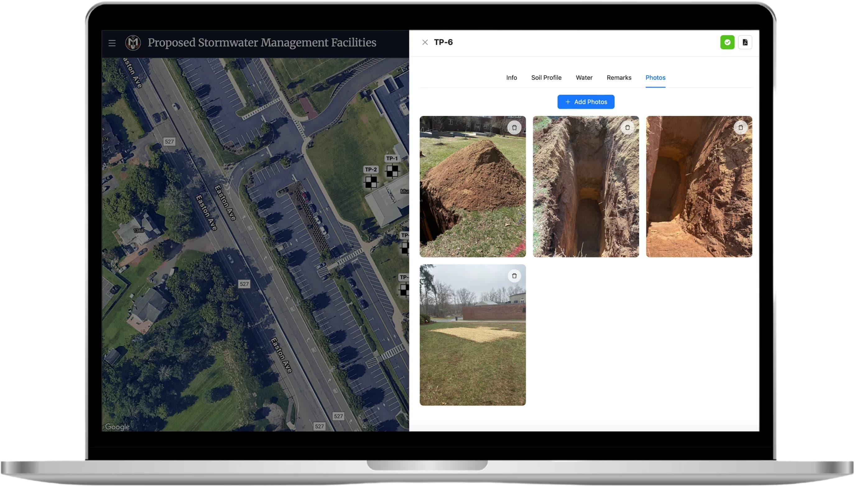
Add and share photos easily
Upload photos directly from the field to each exploration in MonoLog, and reduce photo clutter on your own device.
Edit logs from anywhere
Flexibility is key in today's working environment. MonoLog allows you to edit boring and test pit logs from any device - all you need is an internet connection.

Instantly organize and analyze subsurface data
Data from explorations is automatically organized into a comprehensive summary table. Get immediate insights for easier data interpretation and faster decision making.

Easy. Efficient.
The future is now.
What makes MonoLog different?
Streamlined Data Entry
MonoLog uses the latest AI technology to convert spoken text into a structured log of the subsurface profile, eliminating hours of tedious data entry for field professionals.
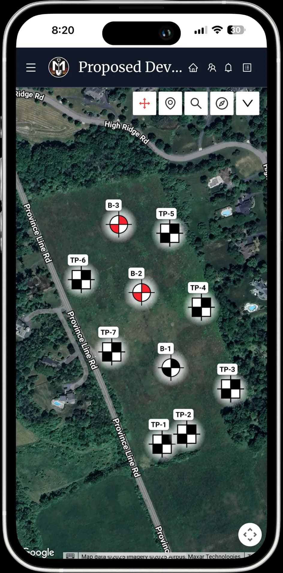
Georeferenced Locations
The coordinates of each boring and test pit location are saved within the application's base map - an aerial image using features provided by Google Maps.
Real-time Updates
Members of the project team can log in from any device to get live updates from the field. Check logs as they get completed to track progress, make edits, or adjust scope as needed.
Instant Data Analysis
Important data from the boring and test pit logs is automatically organized into a subsurface summary table, saving project managers time and resulting in easier data interpretation.
Project Plan Overlay
Overlay project plans onto aerial base map and adjust transparency to view both existing site features and proposed construction simultaneously.
Organized Site Photos
Take photos of site conditions and explorations through the application and save them to the georeferenced locations, making for easier photo storage and sharing that is organized by project.
Need a custom log?
We can design a custom template to match your existing logs, and seamlessly transition you to our platform – or create an entirely new template of your dreams.
Reach out! We'd be happy to discuss options and pricing for any customizations.